Postcards from Pakistan
Postcard from the Kargah Buddha

The layers of history in Gilgit-Baltistan are fascinating. The area began as a number of small, independent states but the region has had many rulers and religious influences, from Chinese, Tibetan, to Mughal, from Buddhism to Islam. All have left lasting influences on art, culture, language and architecture.
Gilgit was an important trading stop on the Silk Road. Buddhist monks from China followed the Silk Road and it became a corridor for the teaching of Buddhism across the region. From the 3rd to the 11th century Gilgit was a major centre for Buddhism and many monasteries and stupas were built.
In 1931 a monastery and three stupas were found along with a large number of manuscripts that can be dated back to the 6th and 7th centuries. The archaeologist Aurel Stein announced the discovery of the manuscripts. They are made from birch bark and because of the dry mountain air they are in a remarkably good condition. In fact, they are the oldest surviving manuscripts in India. They cover a wide range of subjects including religion, folk tales and medicine. Most of the Gilgit manuscripts are in the Indian National Archives while a small number are in the British Library and the Karachi Museum.
Why am I telling you about the manuscripts? The manuscripts included a lot of new information on the region. Aurel Stein continued to make expeditions through the area reporting on findings of monuments and rock carvings. We had come to visit the largest rock carving, the Kargah Buddha.
Archeologists believe that the Kargah Buddha carving was completed in the 7th century. The Buddha can be found high up on the Kargah Nala cliff-face. The Buddha is 15m high and looks out over the Kargah and Shukogah Rivers that flow down to meet the Gilgit River.
There is also a legend about the carved figure, known locally as Yshani. Yshani was a man-eating giantess who terrorized the area. A holy man managed to pin the giantess to the cliff. The holy man declared that she would no longer bother them as long as he was alive. It is said that the holy man is buried in the foothills and so now the giantess can never be freed.
Now that we don’t have to worry about a man-eating giantess the area is a lovely picnic spot. Recent renovations have improved the road up to the Buddha and new stairs make it easy to climb up to get a great view of both the Buddha and the valley below.

View of the Buddha from across the valley

The new road that leads up to the Buddha
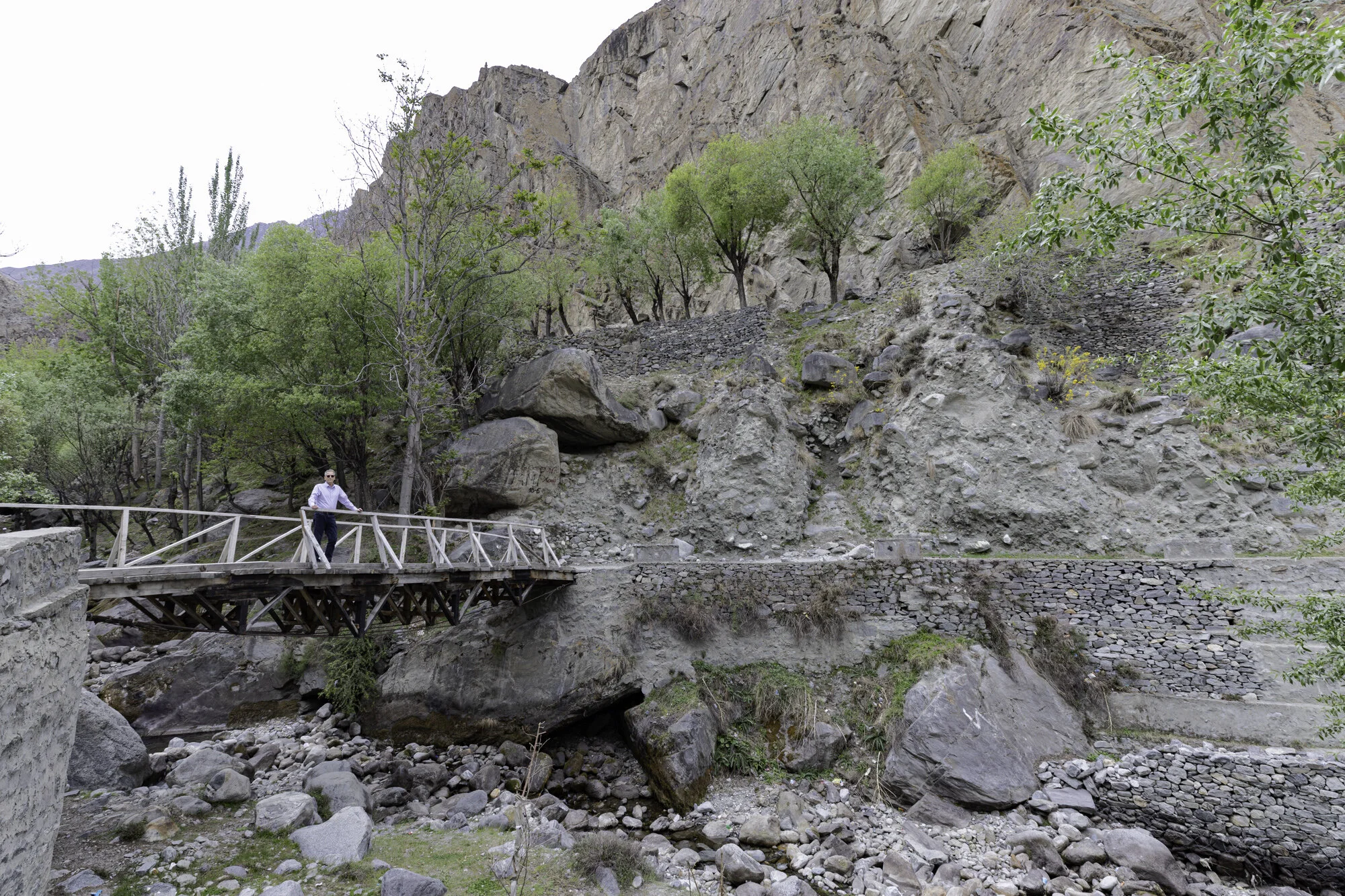
There is a small bridge to cross and an easy walk to the bottom of the stairs

The walkway takes you past rushing water

Edge of an old mill
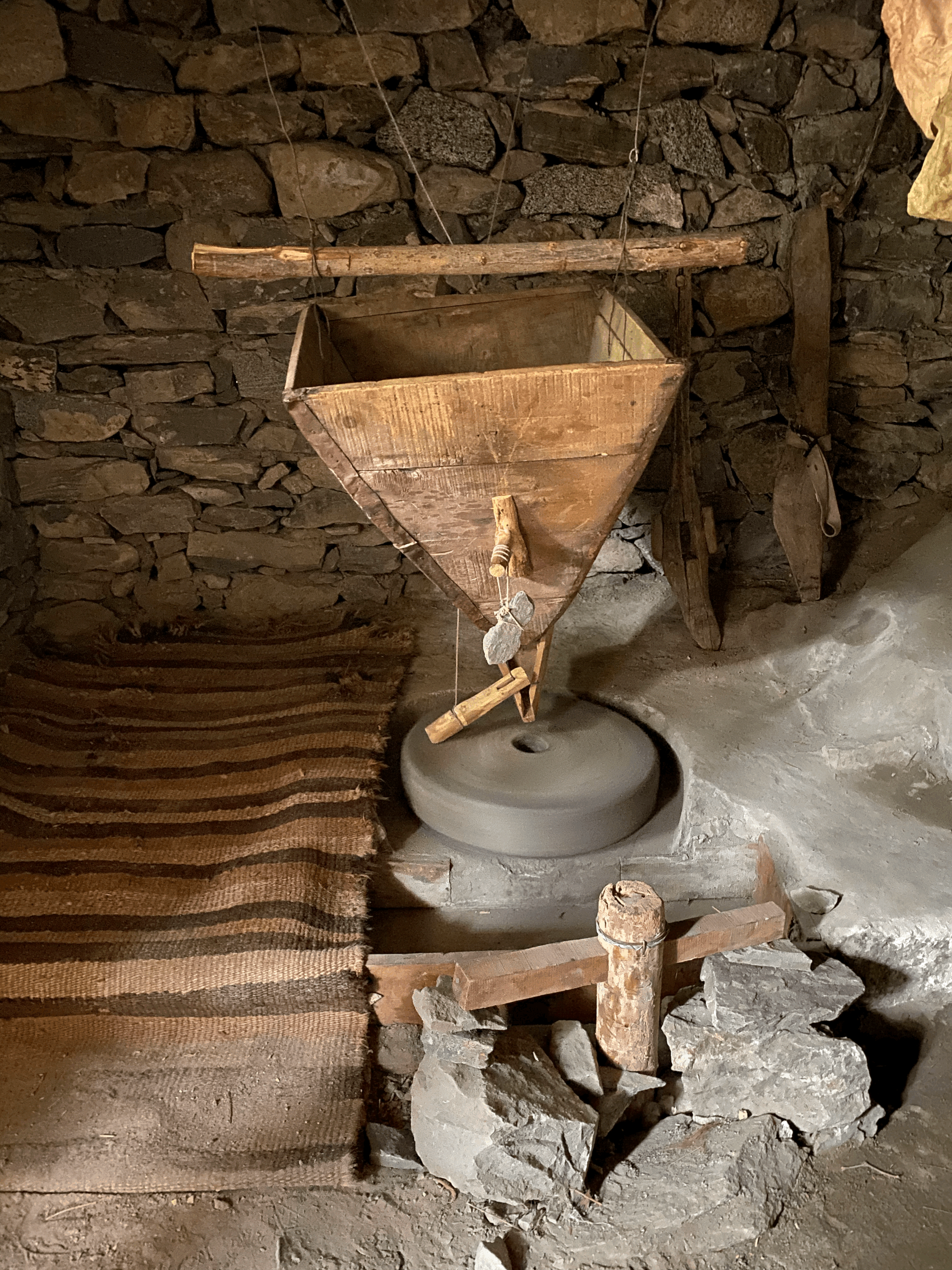
The water was used to power the mill that still works today

The start of a steep walk

Stop, catch your breath, admire the view

Steep but stable stairs
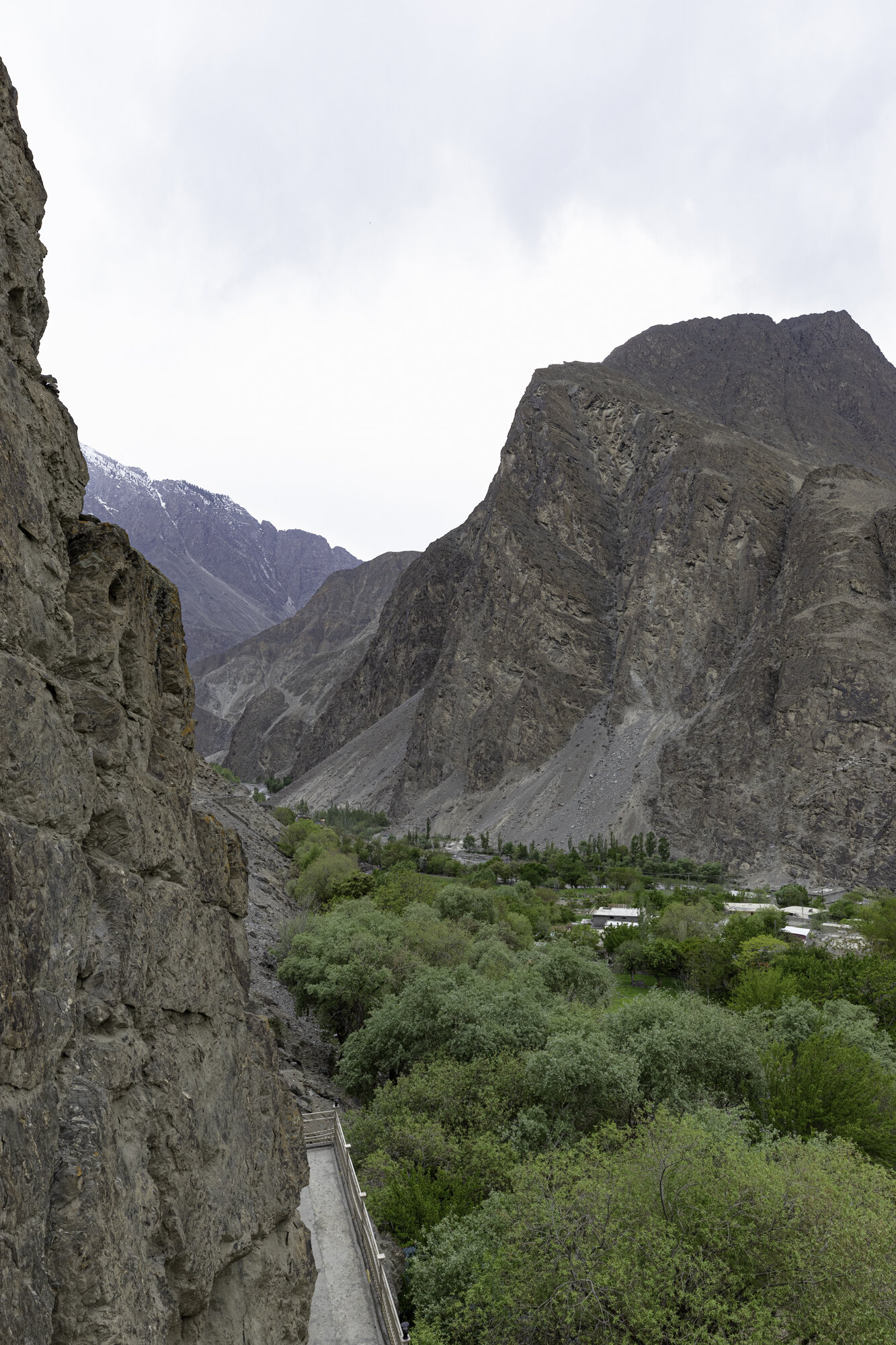
The valley quickly becomes very narrow

Closest view. The holes around the Buddha were believed to be for a wooden structure to protect the carving. Or for pinning down a man-eating giantess!
Postcard from Gilgit

Gilgit-Baltistan covers an area of over 70,000 square kilometres and has an estimated population of nearly 2 million with over 200,000 people living in Gilgit, the capital of the territory. It is bordered by Afghanistan, China, Pakistan Administered Kashmir and Indian Administered Kashmir. Gilgit-Baltistan is an administered territory of Pakistan and constitutes the northern portion of the larger Kashmir region. Kashmir has been subject of a dispute between India and Pakistan since 1947.
To say that the region is mountainous is a massive understatement. It is home to three mountain ranges: Hindu Kush, Karakoram, and the Himalayas. It has five mountains above 8,000 metres: K2 (8611m, Karakoram, just behind Everest at 8850m); Nanga Parbat (8126m, Himalayas); Gasherbrum I (8068m, Karakoram); Broad Peak (8047m, Karakoram); Gasherbrum II (8035m, Karakoram). It also has more than fifty mountains above 7,000 metres.
The airport in Gilgit is surrounded by mountains and the approach is difficult. Poor weather or high winds mean many flights are cancelled. We are lucky as our flight from Islamabad to Gilgit leaves and takes just over an hour. I’m glad the weather is favourable as we seem to skim over mountain ranges as we fly north and the approach into Gilgit seems to be very close to the side of a mountain. I am also glad that we are not driving to Gilgit as the drive would take around sixteen hours due to poor roads.
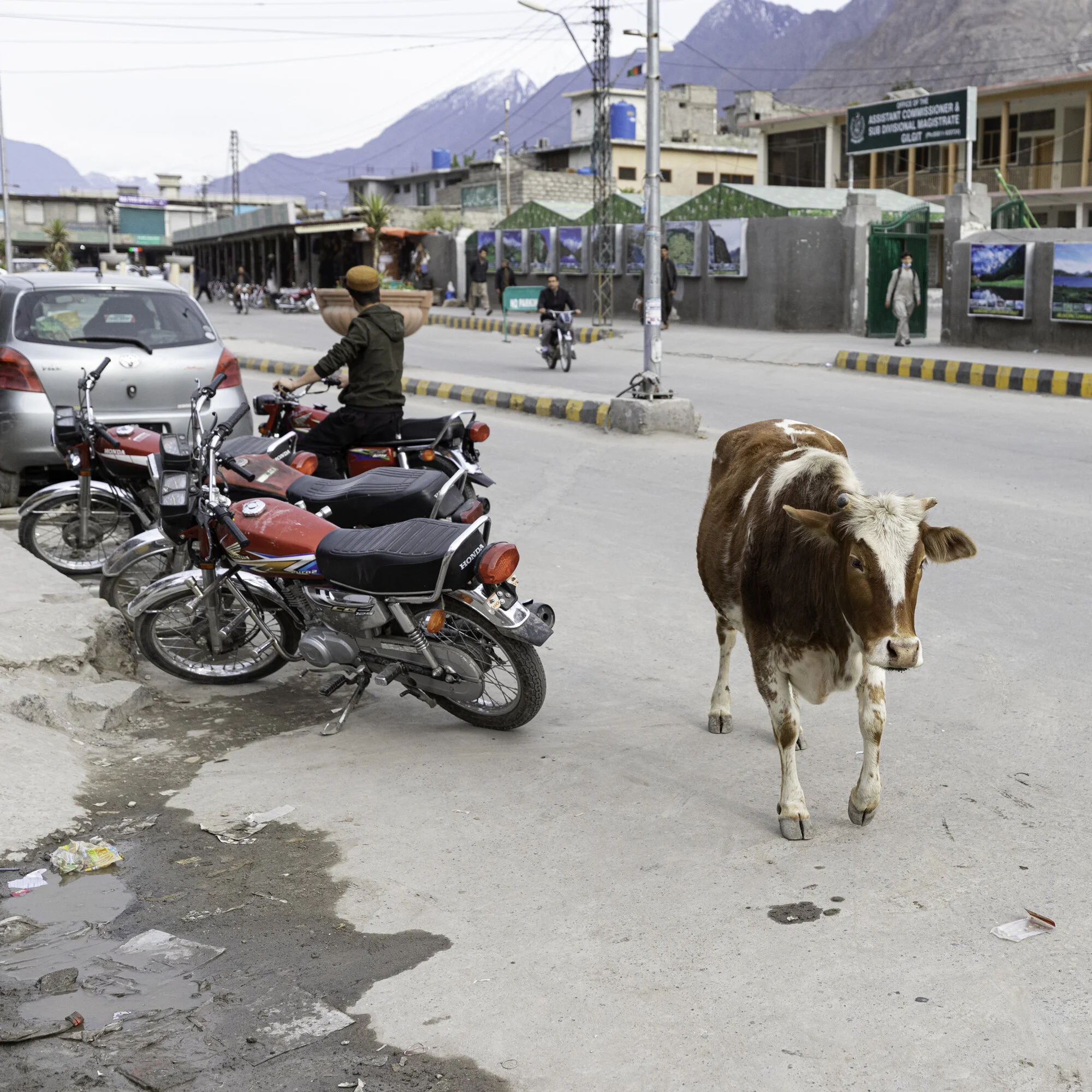
We spend the afternoon looking around Gilgit. The bazaar is quiet as we are travelling during Ramadan. It is watermelon season and everywhere we go we find large barrows with neatly stacked melons, some cut to show off the ruby red inside. There are many shops and stalls selling dried fruit as the area is famous for walnuts and apricots. We visit two suspension bridges, one for cars and one for pedestrians. I’m not sure I would be brave enough to drive a car across the bridge as it is very narrow, the wood creaks and the bridge sways from side to side and up and down. Even with the swaying I manage to take many photos of Gilgit and the river.

Flying from Islamabad to Gilgit

The mountain ranges disappear into the distance

Flying into Gilgit

As you approach the airport you fly very close to the mountains on the left hand side of this photo

The small but welcoming Gilgit Airport

View of Gilgit from the Serena Hotel

Car suspension bridge

Gilgit River

Gilgit River

Just enough room for cars and pedestrians


Orange tarpaulins cover livestock

Pedestrian suspension bridge

The end of the pedestrian suspension bridge and the start of the bazaar

Gilgit Bazaar

Gilgit Bazaar

Selling jalebis (orange swirls - batter is fried and soaked in a sugar syrup) and samosas

Naan seller

Watermelon season

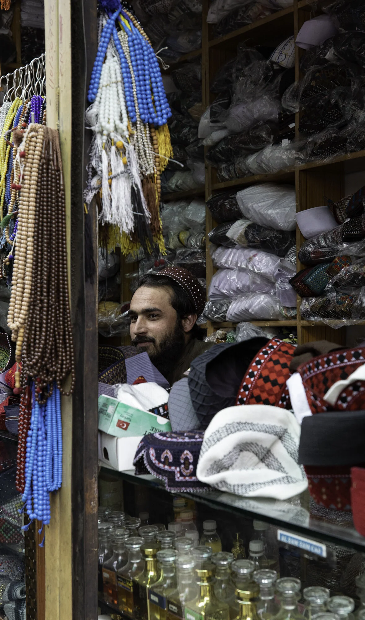
Traditional topi (hats), tasbih (prayer beads) and perfume
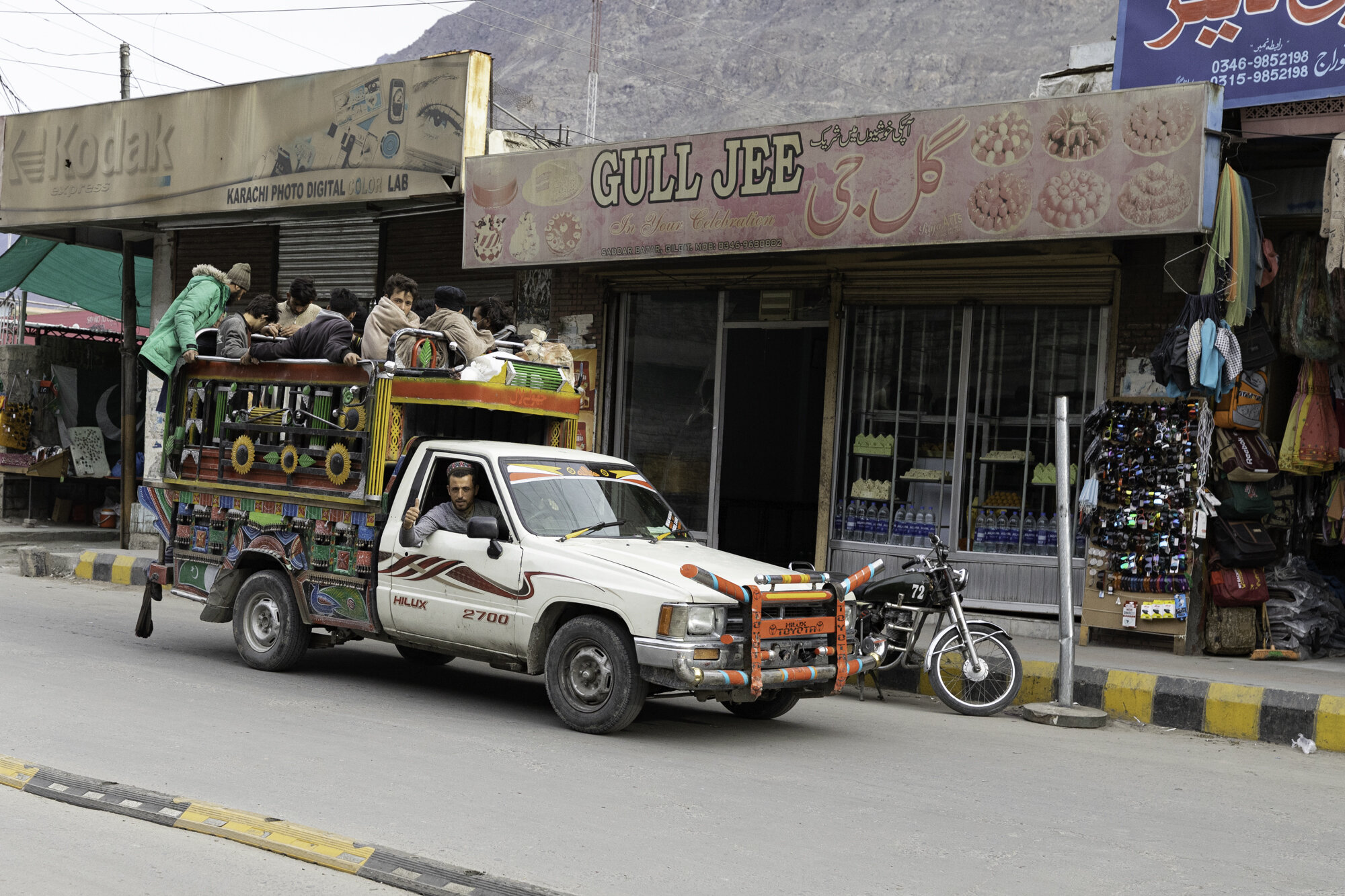
A thumbs up from a local
Another friendly local wandering along the Main Street

Dried fruit and nut seller

