Postcards from Pakistan
Postcard from Passu - a glacier, a cathedral, a bridge

After leaving the Khunjerab National Park we head back to Hunza, stopping in Passu. Pakistan has over 7,000 known glaciers and contains more glacial ice than any other country outside the polar regions. Pakistan has a population of over 220 million people who rely on glacial water for drinking water and farming. However, Pakistan’s glaciers are receding. Rapid glacial melt has lead to flash flooding, avalanches, landslides, destruction of infrastructure and loss of life.
In the south of Passu is the Passu Glacier. This glacier links up with a number of other glaciers in the region. The Passu Glacier is 20.5 kilometres long, spread over 115 square kilometres. Behind the glacier sits Passu Peak at 7,478m.
The view from the road is breathtaking, on the left is the Passu Glacier and on the right is Tupopdan, also known as Passu Cones or Passu Cathedral. This mountain range stands at 6,106 metres above the Hunza River. Tupopdan is the local name for the mountains and it means ‘sun gulping mountains’ but as we were there on a very cold and overcast day I will have to believe the locals. The sharp peaks made me think of a sleeping dragon, but I could also see the reference to cathedral spires.
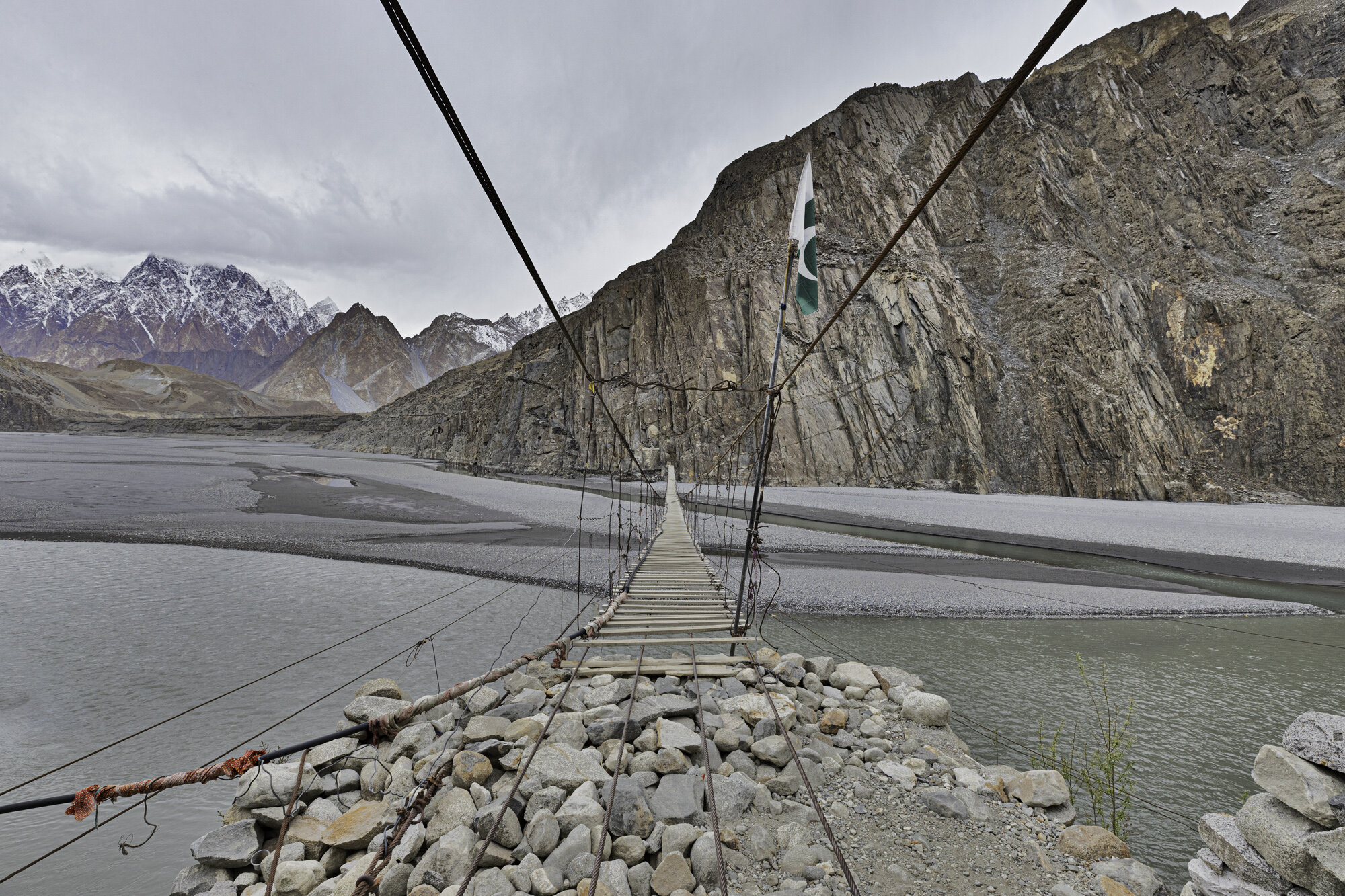
We had also stopped in this area to see and perhaps walk across the Hussaini Suspension Bridge. It is a pedestrian bridge that crosses the Hunza River so you can walk to Zarabad Hamlet from Hussaini Village. The Bridge has been washed away a number of times due to flash flooding. It is made of wooden planks, some narrow, some wide, each plank is set at a different width to its neighbour making it very difficult to walk with confidence. It also moves up and down as other people cross the bridge and swings side to side in the wind.
I slowly stepped out onto the bridge, it moved slightly side to side, I kept walking and when someone walked closely behind me the bridge moved up and down and I felt like I was on a trampoline. I waited until they had passed by and kept walking, slow by slow step, holding tightly to the metal wires. As you move further along and further out over the river the bridge moves a lot more, but I was gaining in confidence and started to walk a little bit quicker. I made it to the other side and was feeling pleased with my daring walk only to see two locals quickly walk across the bridge without holding on! I was so fascinated with their progress I forgot to take a photo of them.
I turned around and walked back across the bridge, I was happy to have walked across and even happier to be back on safe, non-rocking ground.

On the far left is Passu Glacier with the Passu Cones in the centre

Passu Glacier

Tupopdan, also known as Passu Cones or Passu Cathedral

Our first view of the Hussaini Suspension Bridge

Looks much longer up close
Ready to start


View from the opposite bank

Steps leading up to Zarabad Village

Some thick planks and some exceptionally thin ones

I’ve made it back!
Postcard from Baltit Fort

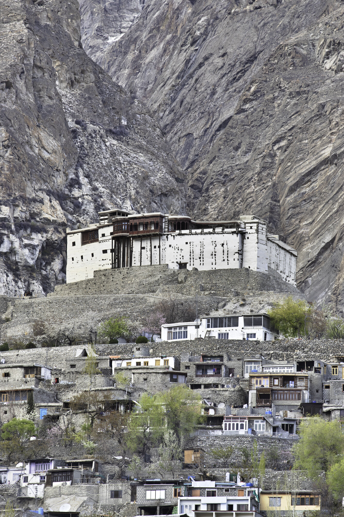
When you first arrive in Hunza you can see Baltit Fort sitting high above the valley with a wondrous backdrop of snow-covered mountains. It is close to Altit Fort (the subject of my previous blog) but where Altit sits next to the Hunza River, Baltit Fort seems to float in front of the mountains and the Ultar Glacier.
Be ready for a steep climb through the town of Karimabad to reach the entrance to Baltit Fort and then be ready to climb more steps to get to the front door and yet more steps inside. The effort is worth it. Baltit Fort is an impressive building with even more impressive views of the whole Hunza Valley.
The site was obviously chosen for its strategic importance for security, water and trade. The Fort was built 700 years ago on a flattened rock spur and floors and rooms have been added over time. Notable changes came about in the 16th century when the local Mir (king) married a Baltistan princess. As part of her dowry renovations were made by Balti craftsmen and you can see Tibetan influences in the shape of the ceilings and on door supports.
In my last blog on Altit Fort I wrote about two princes, Prince Shah Abbas and Prince Ali Khan and their disagreement that led to the death of the younger prince. Prince Shah Abbas made Baltit Fort the new seat of power for the region. It remained the palace until 1945 when the Mir built a new palace close by.
Left empty and in need of serious repairs there was concern that the Fort would become a ruin. Six years of renovations were completed in 1996 by the Aga Khan Trust for Culture. The renovations have been done exceptionally well and have kept the original feel of the Fort. From the soot stained and charred ceilings in the kitchens to the colourful mosaic windows open to the cool wind from the surrounding mountains you can start to imagine what life must have been like here.

Baltit Fort at the foot of the Ultar Glacier
Baltit Fort sits on a flattened spur of rock

Walking past traditional houses in Karimabad

History around and above every corner

Water was and still is a valuable resource. Water channels were built across Karimabad

Side view of Baltit Fort with clear lines of wood and stone

Just a few more steps to get inside the Fort

Local with traditional woollen Gilgiti cap with shaati feather

Maintenance of Fort and surrounding buildings is hard work as all stone has to be carried by foot

Cannon from 1863


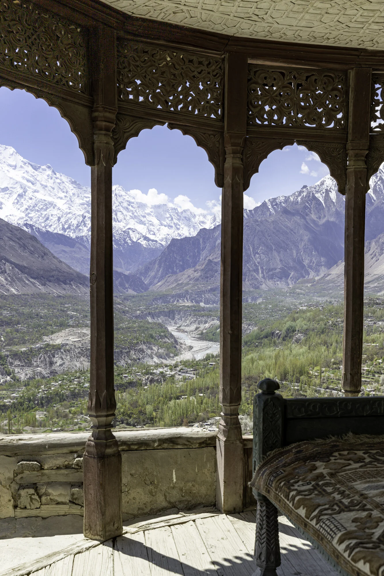
View of Hunza Valley from top terrace


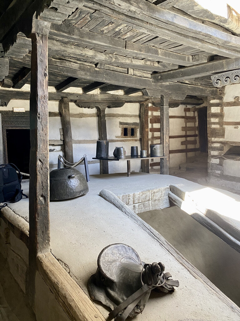


Tibetan inspired ceiling above the kitchen

Centuries of soot and smoke

What do you think this box was used for?

Ceiling detail
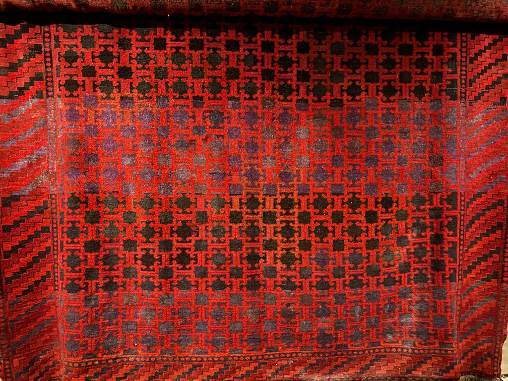


Traditional Hunza woven rugs


In the mid ground you can see Altit Fort
Postcard from the Hunza Valley

Beautiful blossoms and snow capped mountains will be my lasting impression of the Hunza Valley
The Hunza valley is in the northern part of Gilgit-Baltistan at an elevation of 2,438 meters. Afghanistan is to the north and China is to the northeast. The Hunza River runs through the valley and you can still see remains of the Old Silk Road.
We visited during spring and the apricot blossom trees were in full bloom. The air was fresh, villages clean and terraces beautifully ordered. It was wonderful to walk along nearly deserted paths and hear nothing but the buzz of bees and the occasional motorbike.
In 1933 a novel by James Hilton was released called ‘Lost Horizon’. In 1937 it was made into a film by Frank Capra. The book and film are set in Shangri-La, a ‘mystical and harmonious’ valley in Tibet that is isolated and where people live for hundreds of years. It is thought that Hilton based his novel on the location and people of the Hunza Valley.
The Hunzakut were rumoured to live exceptionally long lives, to be very fit, to be vegetarian and never get ill. Unfortunately, this has turned out not to be true. The Hunzakut are very fit as most must walk to work in the fields, at altitude. During the summer they do follow a mostly vegetarian diet as the growing season for fresh fruit and vegetables is very short. Animals are kept for meat for during the long winter months. As Hunza is very difficult to reach a lot of diseases did not arrive until roads opened up the valley. As to living very long lives this depends on how you measure age. Apparently the Hunzakut do not measure age solely by years but also by wisdom.
If you are ‘wise beyond your years’ you will visit Hunza as it is a beautiful place filled with stunning landscapes and hospitable people.

Hunza Valley from Altit Fort

Hunza Valley panorama taken from Altit Fort. Hard to give you a sense of being surrounded by mountains

Hunza Valley from Baltit Fort

Snow gives way to barren mountain sides. Those squiggly lines in the middle are roads going up high into the mountains.

The Hunza River runs through the centre of the valley

Blossoms above and below
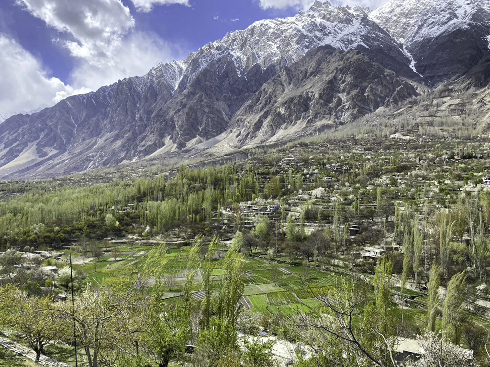
Poplar trees and patchwork terraces

A man rests and checks his phone

Pink blossoms against a blue sky and white snow capped mountains

Clouds lift and we can see the mountains from our hotel

Delicate apricot blossoms

The day ends, the sun sets, we watch the changing light on the mountains.